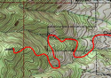
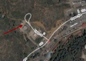
LOCATION:
Start in the High Drive parking lot
TRIP TIME:
2 hours
DISTANCE:
5 miles
ELEVATION:
Start- 7,500 ft
Top 8,700 ft
WHAT TO BRING:
-Water bottle
-A Band-Aid
-Running shoes/ light hikers


SEVEN BRIDGES


RESOURCES:


SEVEN BRIDGES


RATING:
Scenery- 8
Crowds- 4 (10 is packed)
Difficulty- 5
My Overall- 7
THE HIKE:
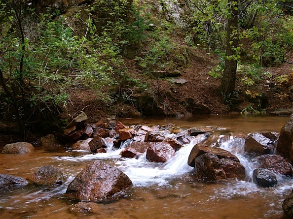
The Seven Bridges Trail crawls up North Cheyenne Canyon. It follows and crosses the creek, and the creek compliments the trail the whole way.
THE ROUTE:
In some places, the Seven Bridges Trail can be a challenge. It’s littered with rocks and tree roots, and there are steep sections full of scree. But they go quickly, and the noise of the river helps to drown-out your tired thoughts.
For the most part, the trail is well-packed and easy to follow. Every bridge is more than safe. It’s hard to cross any of them without pulling out a camera.
GOOD TO KNOW:
-Not that you want to be outside in a lightning storm, but if you are, this isn’t a bad place to be. It’s a good hike to save for a cloudy afternoon.
-Right before you turn off Upper Gold Camp, Cheyenne Creek goes under the road in a culvert. When the water isn’t too high or too low, it makes for a great water slide.
CLICK FOR SEVEN BRIDGES ALBUM