LOCATION:
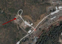
Southwest. Use the High Drive parking lot.
GOLD CAMP ROAD
TRIP TIME:
1-3 hours
DISTANCE:
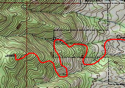
The road is 9 miles long. Hike it all or just part.
ELEVATION:
Start- 7,475 ft
End- 9,050 ft
RATING:
Scenery- 8
Crowds- 7 (10 is packed)
Difficulty- 3
My Overall- 6
WHAT TO BRING:
-Water bottle
-Running shoes/ light hikers
-Might want an extra layer


GOLD CAMP


RESOURCES:


THE HIKE:
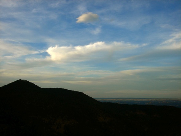
Upper Gold Camp Road is a mellow hike. It’ll never surprise you and it’ll have trouble wearing you out. But it will make you relax. And you’ll kinda forget about everything else.
ROUTES:
Gold Camp Road was built for mining-trains in the 1880’s. About 50 years later it was modified for automobile traffic. But now, thanks to a collapsed tunnel, it’s only open to hikers and bikers.
The road winds all the way to Old Stage. It’s nine miles of inviting 3% grade. Silver Cascades Falls is off to your left at mile 1.5, and the trail to Saint Mary’s Falls is on your right at mile 2. Hop onto a side trail, hike the whole road, or turn around whenever you want.
Sometimes I stop at a little cabin- a quaint place covered with the fingerprints of family. If you make this your turnaround point, you’re looking at a 5 mile roundtrip.
Running is not a bad option for the way down. It’s an easy jog and you’ll be down in 1/3 the time. But whether you walk or run, make sure to enjoy.
GOOD TO KNOW:
--This trail is far from hard, but that makes it a great place to talk and hike. So bring a friend.
-If you go in the evening, be sure to take Lower Gold Camp Road down. It might have the best view of city lights in Colorado Springs.
-Three quarters of a mile up, Cheyenne Creek goes under the road in a culvert. When the water isn’t too high or too low, it makes for a great water slide.

CLICK FOR GOLD CAMP ROAD ALBUM